
Post Falls ZIP Coverage Explained
Post Falls has one clear street-delivery starting point and one local code that needs care. USPS identifies 83854 at the Post Falls Post Office and uses the ZIP+4 83854-9998 for the facility itself. The code 83877 appears in official city utility and school-district examples for PO-box or institutional mail. That evidence does not make 83877 a second general street-delivery polygon.
| ZIP | Areas Covered | Post Office | Local Note |
|---|---|---|---|
| 83854 | Ordinary Post Falls street-delivery identity; exact route depends on address | Post Falls Post Office, 405 N Greensferry Road | Facility uses 83854-9998 |
| 83877 | PO-box and institutional examples tied to Post Falls | Confirm the specific box or organization | Not supported as a universal street ZIP |
A flat ZIP list would blur those roles. Use the USPS ZIP Code Lookup for a current address result, and preserve the full standardized city, state, and ZIP that USPS returns.
Post Falls ZIP Code 83854
The Post Falls Post Office details page supplies the strongest official anchor for 83854. It lists the office at 405 N Greensferry Road and publishes its current services, telephone, and hours. Those facility facts identify the postal office. They do not draw a municipal boundary or prove that every address bearing “Post Falls” lies in the incorporated city.
The successful office capture preserves the source context:
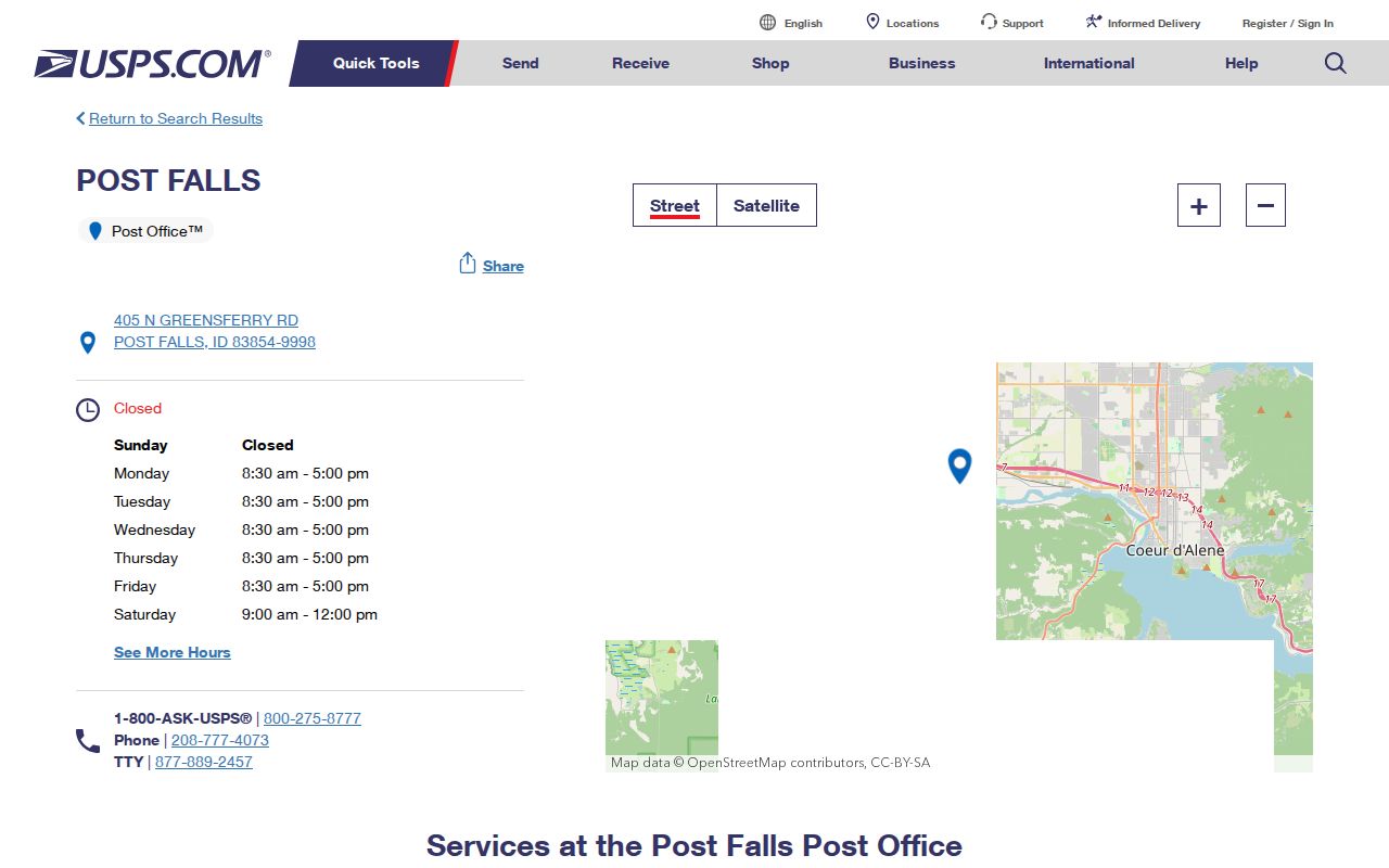
Check the live office page before a visit because service windows can change. For resident research, use the standardized ZIP only to narrow the place, then confirm the parcel or public record with its custodian.
Why Post Falls Shows 83877
The two-code puzzle is a useful local geography lesson. Official city utility mail and an education record use 83877 in PO-box or institutional contexts. USPS office evidence points to 83854 for the main Post Falls street-delivery identity. A code printed on agency mail can describe how that organization receives mail, not a second set of residential streets.
Do not “correct” 83877 when it appears on a cited institutional record. Label its role. For a house, shop, school site, or parcel, enter the physical street address in USPS lookup and use the returned code. For a box, use the box holder’s supplied mailing form. This distinction protects a ZIP code directory from turning a routing example into a false neighborhood boundary.
Post Falls mail rule. Treat 83854 as the street-delivery starting point and verify any 83877 use as a box or institutional address.
Search Post Falls ZIP by Address
The USPS city-and-state tool is useful for a list, but the address mode is more precise. Enter a complete street line when one is known. USPS standardization can resolve direction, suffix, unit, delivery city, five-digit code, and ZIP+4. A current exact-address result is better evidence than an old mailing label or an unsourced static map.
| USPS Field | Input | Result Use |
|---|---|---|
| Street address | Number, directional, street name, suffix | Matches the delivery point |
| Apartment or suite | Secondary unit when applicable | Refines ZIP+4 |
| City | Post Falls or the address’s supplied city | Tests the accepted postal label |
| State | Idaho | Limits the place |
| ZIP result | Five digits plus optional four | Use as returned, then compare jurisdiction |
The captured USPS lookup provides the official starting surface:
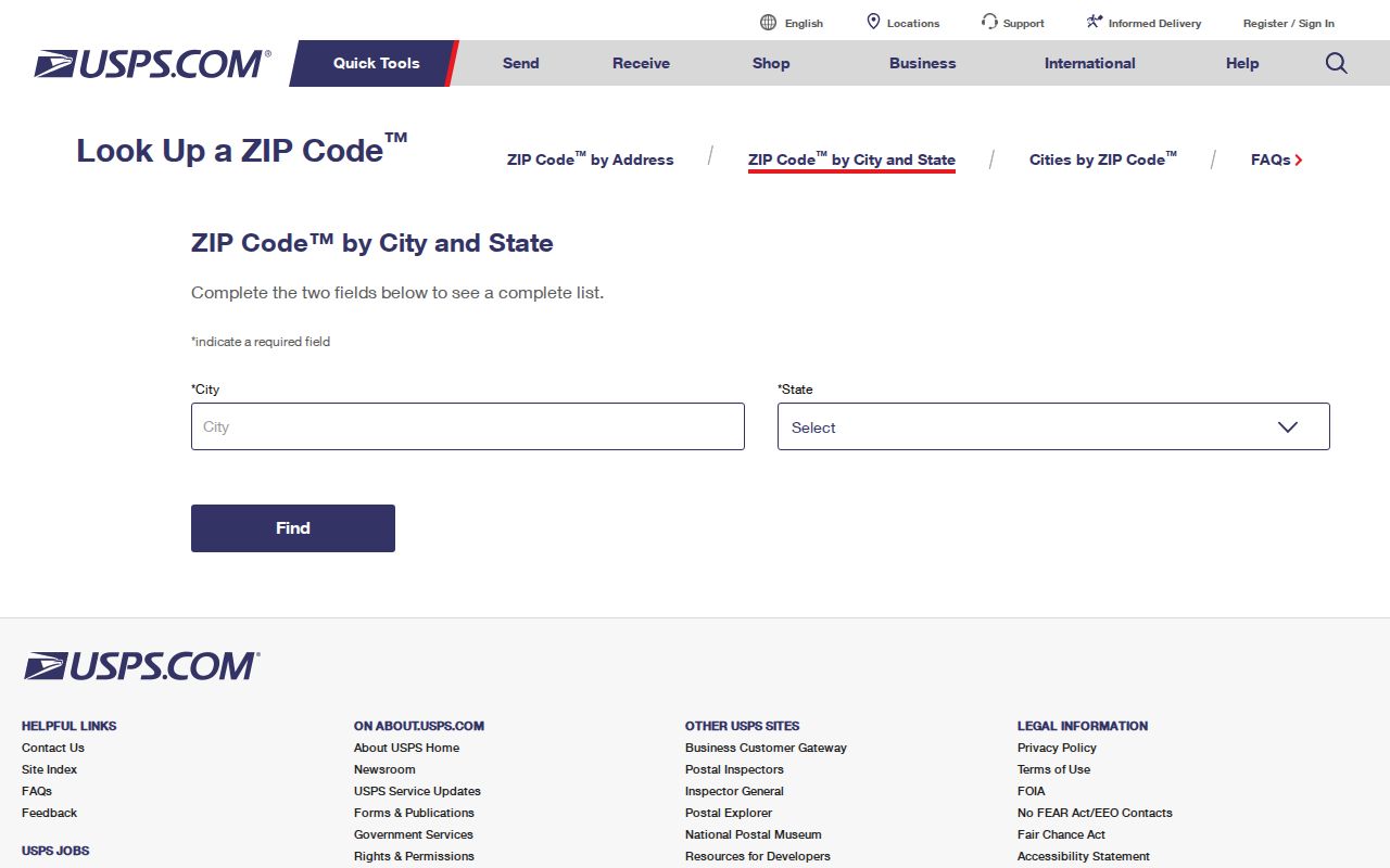
Run the exact address again after any street-number, directional, or unit change. The output is a delivery answer, not an owner or occupant record.
Finding Post Falls Residents by ZIP
A Post Falls ZIP code directory can narrow a broad name or place query, but the next source must accept that geography. The Kootenai Assessor offers property-address search and returns situs and mailing fields on parcel cards. The city permit layer has a location field for address-keyed projects. Neither source should be described as a ZIP-wide resident list. Kootenai voter requests use county, legislative district, taxing district, or precinct scope, not a ZIP selection.
- Standardize the exact address through USPS. Save the returned city, five-digit ZIP, and ZIP+4 if present.
- Search the Kootenai Assessor by full property address. Record the PIN, AIN, situs, legal description, and owner role.
- Compare the parcel with the Post Falls city boundary or the county GIS. Do not infer city jurisdiction from the postal label.
- When the inquiry expands to a named street, use the Post Falls street directory workflow for parcel-by-parcel checks.
When only a ZIP is known, combine it with a surname, exact street, parcel ID, or official report scope. ZIP alone is too broad to identify a resident safely.
Map Post Falls ZIP Context
Post Falls publishes GIS service layers that help compare postal context with municipal geography. The city base map includes the city boundary, parcels, streets, buildings, parks, waterways, highways, railroad, and nearby cities. A separate service-area map exposes public legends and boundary layers. These are map aids. They do not replace USPS delivery data.
The successful ZIP map legend capture shows the official layer context:
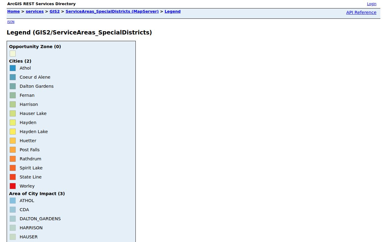
Read the layer name and update information before assigning meaning. A service district, precinct, tax district, and postal route may overlap while keeping different boundaries.
Post Falls has grown quickly, from 38,485 people in the 2020 census to a July 2025 estimate of 46,715. That change makes static population-by-ZIP claims especially fragile. Census city estimates measure the incorporated city and should not be converted into a postal resident count.
Reading Post Falls Routing Labels
The USPS Domestic Mail Manual label list groups destinations for mail processing. A line headed with Post Falls can include other destination ZIPs within a sectional-center facility grouping. That heading is a routing label, not a claim that every listed code belongs to Post Falls city.
USPS ZIP Code Basics explains how the system directs mail and how ZIP+4 refines a delivery segment. The captured explanation supplies official definitions rather than map guesses:
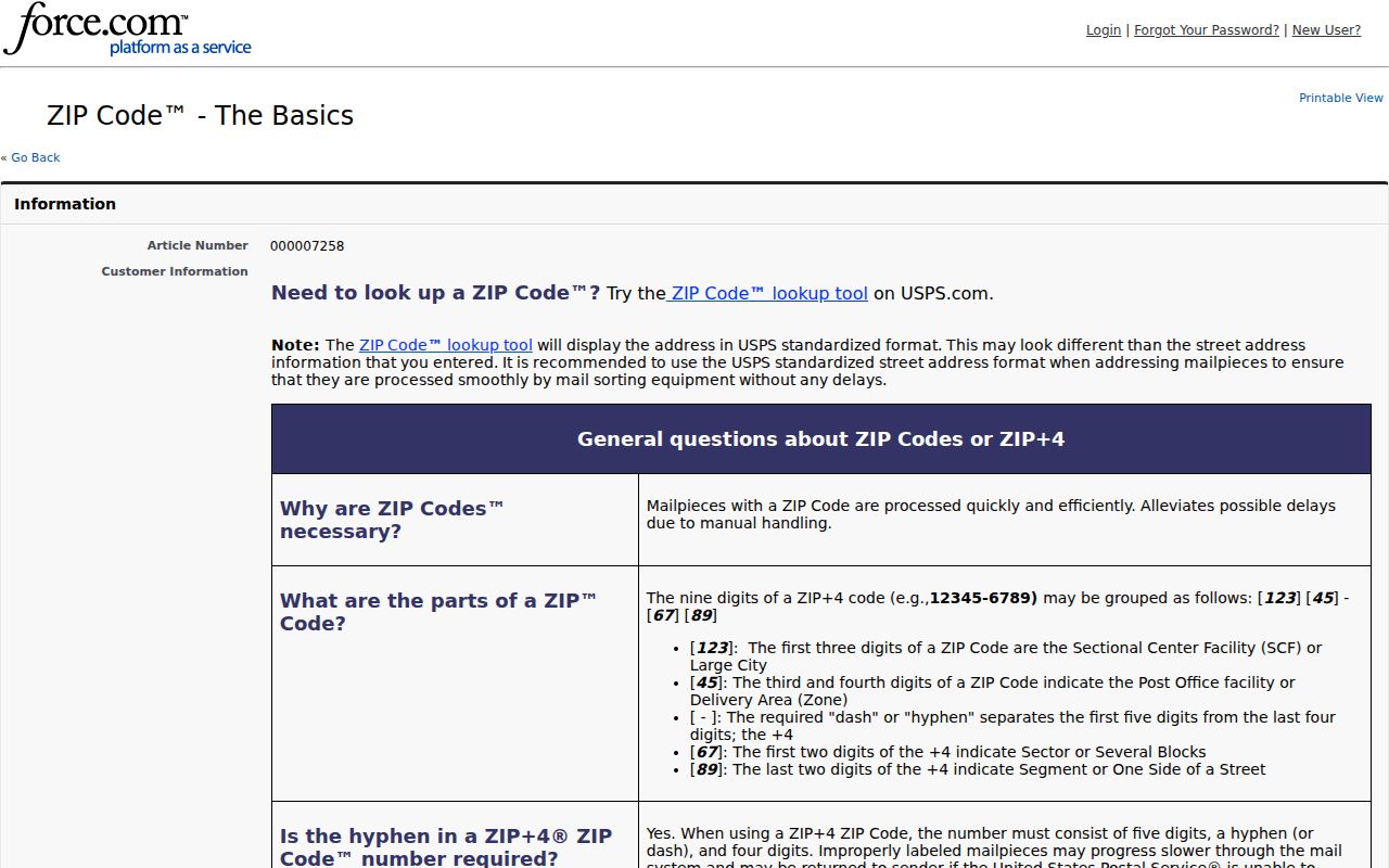
Use DMM labels to understand processing. Use exact-address lookup for delivery. Use the city GIS boundary for incorporation. Keeping those sources in their own lanes prevents the most common Post Falls ZIP error.
Post Falls ZIP and City Limits
A Post Falls mailing label can extend beyond a municipal line. Conversely, a parcel’s tax district or precinct does not dictate its preferred postal city. Near the Washington corridor, Rathdrum Prairie, Spokane River, and routes toward Coeur d’Alene, readers should compare the official city boundary with the parcel’s situs and the USPS-standardized mailing form.
- ZIP code
- A five-digit USPS routing code. It is not a city-limit polygon.
- ZIP+4
- The five-digit code plus four digits that narrow a delivery segment, box group, or organization.
- PO-box ZIP
- A code or delivery use tied to post-office boxes rather than a general street area.
- Unique ZIP
- A code assigned for mail directed to one organization or a very large recipient.
- Carrier route
- A group of delivery points served in a postal route sequence.
The city address grid adds another layer. Spokane Street and 1st Avenue form its origin, and directional letters plus odd-and-even parity matter. Preserve N, S, E, or W when checking an address. USPS, city GIS, and the Kootenai parcel record coordinate around the address but answer different questions.
Post Falls ZIP Is Not Precinct
Kootenai Elections allows requests for countywide, legislative-district, taxing-district, or precinct reports under Idaho election law. The current form does not offer ZIP as the political-geography key. A resident lookup by ZIP should not imply that all voters in 83854 share one precinct, district, or city jurisdiction.
For civic research, identify the parcel or registered address through the permitted source, then ask Elections for the correct public report scope. Public voter fields remain subject to use limits, and ballot choices stay secret. Record the report date because registration and district assignments change.
Note: No official Post Falls ZIP polygon or year-by-year realignment chronology was found, so do not invent a split date or boundary line.
Keep Post Falls ZIP Results Current
Postal tools, map layers, assessor records, and voter pages can change on different schedules. Save the source URL and check date. If USPS and a parcel card disagree, preserve both labels and ask the relevant office which field needs correction. Do not force one system’s geography into the other.
A careful ZIP code directory result has four labeled facts: the USPS delivery form, the parcel’s situs, the incorporated-city status from GIS, and any district used by the requesting agency. That small table is more reliable than a broad claim about who lives in one code. It also gives the next researcher enough detail to repeat the check.
Best check. Re-run USPS for the exact address, then compare the returned ZIP with the parcel and city boundary on the same date.